The Weather Research and Forecasting Model (WRF) is an advanced, community driven, and open source weather model that can be used for both operational forecasting and meteorological research at a variety of scales. Along with The NWU-Lekwena Radar, The NWU-WRF puts the North-West University Potchefstroom at the forefront of numerical weather prediction research in Africa, as the only university running an in-house, student driven operational weather radar and an operational numerical weather prediction model. Read more about WRF on the official user page.
The Weather Research and Forecasting Model Version (WRFV) 4.0, Microphysics=New Thompson, et.al (8), Longwave Radiation=RRTMG scheme (4), Shortwave Radiation=RRTMG scheme (4), Land Surface=Noah Land Surface Model (2), Planetary Boundary layer=Yonsei University scheme (1), Cumulus Parameterization=Grell-Freitas (3), Model Vertical Levels=34
Initialization Strategy

The current UTC time is:
Forecasts
Click links to expand
Precipitation || Radar || Maximum Wind Gust || CAPE || LFC || Cloud Fraction || Temperature
Soundings
Click city names to expand
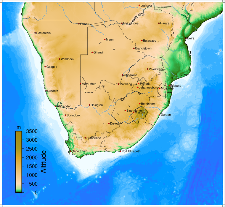
South-Africa
Alexandria || Bethlehem || Bloemfontein || Cape Town || De-Aar || Durban || Irene || Upington || Mafikeng || Polokwane || Port Elizabeth || Springbok || Sutherland || Mata-Mata
Namibia
Windhoek || Rundu || Luderitz || Goageb || Rundu || Sesfontein
Botswana
Gaberone || Ghanzi || Francistown || Maun
Zimbabwe
Mozambique
Zambia
Lesotho and Swaziland
Practical considerations and limitations
- The model is initialized using publicly available GFS data. The GFS forecasts are also viewable here
- The model requires spin-up time to become numerically stable, the first hour of the forecast should be discarded
- For observed Skew-T diagrams please visit the University of Wyoming Upper-Air Database
- Customized forecast products is available on request
- Please note that SAWS is the only entity in South-Africa which can issue weather related warnings