The scan time is burnt into the image. If it differs from the UTC clock by more than about ten minutes, the radar or its link to campus is probably down. The status badge above is set automatically, but only marks the radar offline after two hours without a new scan, so check the time stamp first.
Latest reflectivity
Maximum reflectivity, dBZ
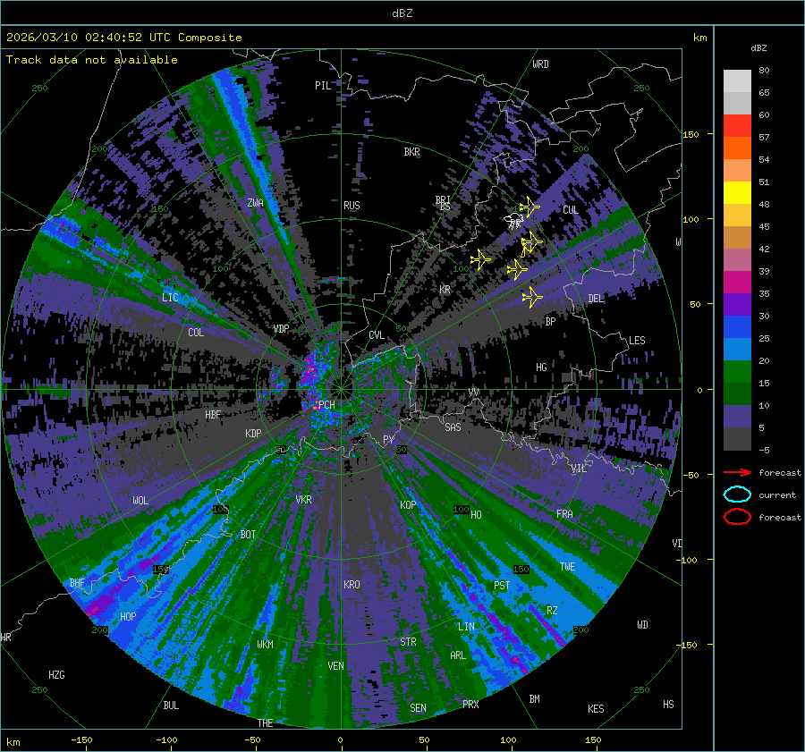
Refreshes every two minutes. Colour scale, place markers and interference are documented on the about page.
Maximum dBZ map
Reflectivity over a basemap; the layer control toggles the radar overlay.
Interactive maximum dBZ

Storm characteristics
Cells are identified and tracked automatically; click a polygon or track for its characteristics. Radio-frequency interference is occasionally tracked as a cell, so cross-check against the reflectivity image above.
Tracked storm cells
Lightning
Total-lightning detections from the volunteer-operated Blitzortung network, in near-real time and independent of the radar. Useful for locating active convection while the radar is out.
Live lightning strikes
Opens on Southern Africa; pan and zoom from there. Scroll-zoom is off, so use the zoom buttons or open the map full screen. Strike locations are triangulated from a volunteer detector network, so coverage and accuracy vary with detector density.
Data and map by Blitzortung.org and contributors.